
Category:Topographic maps of Belgium
Subcategories
This category has the following 4 subcategories, out of 4 total.
Media in category "Topographic maps of Belgium"
The following 18 files are in this category, out of 18 total.
-
 Reliefkarte Provinz Antwerpen 2025.png 6,255 × 4,980; 30.03 MB
-
 Belgium relief.png 3,072 × 2,560; 3.52 MB
-
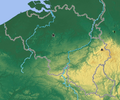 BelgiumGeography.png 330 × 275; 148 KB
-
.png/120px-Carte_de_la_région_Namur_(villes_Bioul_et_Dinant).png) Carte de la région Namur (villes Bioul et Dinant).png 741 × 724; 1.56 MB
Carte de la région Namur (villes Bioul et Dinant).png 741 × 724; 1.56 MB
-
 Reliefkarte Provinz Flämisch-Brabant 2024.png 6,204 × 3,983; 24.69 MB
-
 Gotischer Backstein um Nord- & südliche Ostsee.png 5,248 × 2,250; 11.33 MB
-
 Reliefkarte Provinz Hennegau 2024.png 8,228 × 6,730; 48.25 MB
-
 Kaart van Eksaarde.jpg 1,198 × 1,198; 696 KB
-
 Reliefkarte Provinz Limburg 2025.png 4,351 × 4,653; 21.57 MB
-
 Reliefkarte Provinz Luxemburg 2024.png 5,992 × 6,841; 36.6 MB
-
 Reliefkarte Provinz Lüttich 2024.png 7,259 × 5,278; 33.63 MB
-
 Reliefkarte Provinz Namur 2024.png 5,553 × 6,278; 29.33 MB
-
 Reliefkarte Provinz Ostflandern 2025.png 4,992 × 4,939; 23.44 MB
-
.jpg/120px-Saint-Jean-Sart_-_Knuppelstock_(20).jpg) Saint-Jean-Sart - Knuppelstock (20).jpg 5,312 × 2,988; 6.4 MB
Saint-Jean-Sart - Knuppelstock (20).jpg 5,312 × 2,988; 6.4 MB
-
 Vlaamse Ardennen DTM.png 1,977 × 1,398; 1.15 MB
-
 Reliefkarte Provinz Wallonisch-Brabant 2024.png 4,890 × 2,888; 12.87 MB
-
 Reliefkarte Provinz Westflandern 2025.png 5,221 × 5,167; 19.34 MB
-
 Zonhoven topografie.png 512 × 245; 101 KB


.png)


.jpg)


