
Category:Topographic maps of Greece
Subcategories
This category has the following 12 subcategories, out of 12 total.
Media in category "Topographic maps of Greece"
The following 123 files are in this category, out of 123 total.
-
 Aderes map.png 831 × 545; 348 KB
-
 Imbris 1910 year map.jpg 7,604 × 5,017; 7.55 MB
-
 Aegean Sea map bathymetry ar.svg 4,688 × 5,700; 5.18 MB
-
 Agia Paraskevi Morphological Marking.jpg 980 × 931; 254 KB
-
 Ancient Regions Epirus and Macedon.png 800 × 800; 603 KB
-
 Argolic gulf.jpg 906 × 574; 109 KB
-
 Cape Matapan.PNG 1,197 × 1,056; 212 KB
-
 Chalkidiki - DEM Map Topo - DE.png 2,072 × 1,296; 1.42 MB
-
 Corinth.png 460 × 344; 69 KB
-
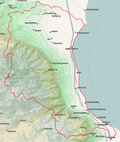
 Dimos Agias Topo.png 776 × 1,087; 1.03 MB
-
 Dimos Alexandreias Topo.png 1,264 × 1,072; 1,022 KB
-
 Dimos Alexandroupolis Topo.png 1,253 × 952; 1.21 MB
-
 Dimos Almirou Topo.png 1,544 × 1,084; 1.9 MB
-
 Dimos Almopias Topo.png 1,404 × 1,001; 2.4 MB
-
 Dimos Amfipolis Topo.png 1,215 × 977; 1.25 MB
-
 Dimos AmpelokiponMenemenis Road.png 1,680 × 1,085; 1.54 MB
-
 Dimos Amyntaiou Topo.png 1,088 × 1,009; 1.42 MB
-
 Dimos Argitheas Topo.png 1,001 × 1,005; 2.27 MB
-
 Dimos Aristoteli Topo.png 1,381 × 1,175; 1.54 MB
-
 Dimos Arrianon Topo.png 1,121 × 977; 1.68 MB
-
 Dimos Avdiron Map.png 1,113 × 1,040; 990 KB
-
 Dimos Delta Topo.png 1,186 × 1,179; 744 KB
-
 Dimos Deskatis Topo.png 1,191 × 1,009; 2.24 MB
-
 Dimos Didymotichou Topo.png 1,356 × 856; 964 KB
-
 Dimos Diou Olympou Topo.png 943 × 1,112; 1.04 MB
-
 Dimos DistomouArachovasAntikyras Topo.png 1,023 × 981; 1.85 MB
-
 Dimos Doxatou Topo.png 1,521 × 1,095; 793 KB
-
 Dimos Dramas Topo.png 657 × 1,063; 1.25 MB
-
 Dimos Edessas Map.png 1,499 × 1,005; 562 KB
-
 Dimos Edessas Topo.png 1,487 × 1,007; 2.68 MB
-
 Dimos Elassonas Topo.png 1,013 × 1,092; 2.07 MB
-
 Dimos Emmanouil Papa Topo.png 894 × 1,065; 1.37 MB
-
 Dimos Eordaias Topo.png 1,103 × 1,008; 1.59 MB
-
 Dimos Farkadonas Topo.png 1,302 × 1,079; 2.09 MB
-
 Dimos Farsalon Topo.png 1,319 × 1,087; 1.76 MB
-
 Dimos Florinas Topo.png 1,602 × 1,117; 2.29 MB
-
 Dimos Grevenon Topo.png 1,429 × 1,005; 2.81 MB
-
 Dimos Halkidonos Topo.png 1,167 × 1,112; 1.22 MB
-
 Dimos Iasmou Map.png 1,012 × 978; 989 KB
-
 Dimos Irakleias Topo.png 1,046 × 1,060; 953 KB
-
 Dimos Kalampakas Topo.png 1,920 × 1,014; 3.46 MB
-
 Dimos Karditsas Topo.png 856 × 1,074; 1.35 MB
-
 Dimos Kassandras Topo.png 1,667 × 1,172; 1.2 MB
-
 Dimos Kastorias Topo.png 1,162 × 1,009; 1.97 MB
-
 Dimos Katerinis Topo.png 1,657 × 1,200; 3.1 MB
-
 Dimos Kato Nevrokopiou Topo.png 1,316 × 984; 2.25 MB
-
 Dimos Kileler Topo.png 1,524 × 1,084; 1.46 MB
-
 Dimos Kilkis Topo.png 878 × 1,032; 1.17 MB
-
 Dimos Komotinis Topo.png 997 × 981; 1.17 MB
-
 Dimos KordeliouEvosmou Road.png 1,392 × 1,148; 1.12 MB
-
 Dimos Kozanis Topo.png 1,142 × 1,011; 1.94 MB
-
 Dimos Langada Topo.png 877 × 1,117; 1.54 MB
-
 Dimos Lariseon Road.png 1,296 × 1,144; 718 KB
-
 Dimos Lariseon Topo.png 1,150 × 1,079; 1.57 MB
-
 Dimos Limnis Plastira Topo.png 1,231 × 1,081; 2.11 MB
-
 Dimos Maronias-Sapon Map.png 1,242 × 898; 1.2 MB
-
 Dimos Mouzakiou Topo.png 1,571 × 1,082; 2.44 MB
-
 Dimos Mykis Map.png 1,275 × 942; 2.13 MB
-
 Dimos Naousas Topo.png 1,352 × 976; 2 MB
-
 Dimos NeapolisSykeon Road.png 1,550 × 1,117; 1.54 MB
-
 Dimos Neas Propontidas Topo.png 1,073 × 1,172; 1.15 MB
-
 Dimos Nestoriou Topo.png 743 × 1,071; 1.57 MB
-
 Dimos Nestou Map.png 724 × 934; 798 KB
-
 Dimos Notiou Piliou Topo.png 993 × 1,144; 1.13 MB
-
 Dimos Orestiadas Topo.png 1,298 × 967; 1.14 MB
-
 Dimos OrestidosTopo.png 1,670 × 948; 2.8 MB
-
 Dimos Paionias Topo.png 1,100 × 1,009; 1.36 MB
-
 Dimos Palama Topo.png 1,759 × 1,042; 1.62 MB
-
 Dimos Pangeou Map.png 1,305 × 950; 1.2 MB
-
 Dimos Paranestiou Topo.png 952 × 1,013; 1.93 MB
-
 Dimos Pavlou Mela Road.png 958 × 1,106; 938 KB
-
 Dimos Pellas Topo 2.png 1,191 × 1,019; 1.09 MB
-
 Dimos Pellas Topo.png 1,255 × 1,148; 975 KB
-
 Dimos Polygyrou Topo.png 1,354 × 1,175; 1.92 MB
-
 Dimos Prespon Topo.png 1,049 × 1,116; 2.01 MB
-
 Dimos Prosotsanis Topo.png 1,165 × 984; 1.45 MB
-
 Dimos Pydnas-Kolindrou Topo.png 1,477 × 1,117; 2.14 MB
-
 Dimos Pylis Topo.png 1,920 × 1,054; 3.99 MB
-
 Dimos Riga Feraiou Topo.png 1,146 × 1,148; 1.48 MB
-
 Dimos Serron Topo.png 967 × 1,001; 1.12 MB
-
 Dimos Servion-Velventou Topo.png 896 × 1,012; 1.52 MB
-
 Dimos Sintikis Topo.png 1,663 × 871; 2.09 MB
-
 Dimos Sithonias Topo.png 955 × 1,172; 825 KB
-
 Dimos Skydras Topo.png 760 × 1,065; 1.13 MB
-
 Dimos Sofadon Topo.png 817 × 1,148; 1.09 MB
-
 Dimos Soufliou Topo.png 1,113 × 978; 1.53 MB
-
 Dimos Tempon Topo.png 853 × 1,142; 1.32 MB
-
 Dimos Thermaikou Topo.png 1,290 × 1,172; 1.23 MB
-
 Dimos Thermis Topo.png 1,322 × 1,117; 2.23 MB
-
 Dimos Trikkaion Topo.png 1,291 × 1,085; 1.77 MB
-
 Dimos Veroias Topo.png 1,058 × 999; 1.5 MB
-
 Dimos Visaltias Topo.png 1,636 × 980; 2.02 MB
-
 Dimos Voiou Topo.png 1,560 × 1,005; 2.52 MB
-
 Dimos Volvis Topo.png 1,732 × 1,099; 3.02 MB
-
 Dimos Xanthis Topo.png 1,624 × 1,005; 2.55 MB
-
 EpirusMycynaen.jpg 359 × 353; 32 KB
-
 Euboea topo.png 1,500 × 1,117; 1.68 MB
-
 Gerakas Morphological Marking.jpg 980 × 931; 254 KB
-
 Greece 34 43 17 30 blank map.png 1,197 × 1,056; 107 KB
-
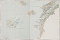
.jpg/120px-Greece_and_the_Aegean_(Times_Survey_Atlas_of_the_World_1922).jpg) Greece and the Aegean (Times Survey Atlas of the World 1922).jpg 901 × 715; 313 KB
Greece and the Aegean (Times Survey Atlas of the World 1922).jpg 901 × 715; 313 KB
-
 Greece Physiography.jpg 2,008 × 2,673; 1.54 MB
-
 Greece topo.jpg 1,400 × 1,193; 547 KB
-
 Griechenland topo.jpg 1,400 × 1,193; 535 KB
-
 Halandri Morphological Map.jpg 980 × 931; 255 KB
-
 Imbris 1829 year map.jpg 3,714 × 2,472; 3.9 MB
-
 Kreta topo prefekturen inseln.jpg 636 × 271; 39 KB
-
 Le golfe de corinthe.png 630 × 454; 361 KB
-
 Location of Locris.png 301 × 301; 51 KB
-
 Map-of-greece.jpg 1,276 × 1,214; 1.52 MB
-
 Mesogeia attica map.png 794 × 523; 340 KB
-
 Meyisti.png 587 × 381; 58 KB
-
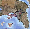
 Peloponnesian War - North - Culture.png 1,600 × 1,207; 634 KB
-
 Pendeli Map.jpg 950 × 978; 257 KB
-
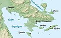
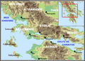
 Prespavalley.png 725 × 904; 484 KB
-
 Rhodos topo.png 1,500 × 1,496; 1 MB
-
 Samothraki Topo.png 1,485 × 908; 1.11 MB
-
 Skorpios map.png 717 × 800; 212 KB
-
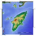
 Thasos Topo.png 1,174 × 1,148; 1.29 MB
-
 Thriasio map.png 690 × 472; 274 KB
-
 Topographic Map Of Chech.png 1,952 × 1,373; 3.92 MB
-
 Valley of Spercheios location map.png 800 × 325; 338 KB
-
 Valley of Spercheios map.png 800 × 362; 379 KB
-
 केलिप्सो गर्त.png 1,003 × 825; 1.47 MB


.jpg)


