
Category:Topographic maps of Liechtenstein
Subcategories
This category has the following 2 subcategories, out of 2 total.
Media in category "Topographic maps of Liechtenstein"
The following 14 files are in this category, out of 14 total.
-
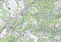
 1115 Säntis.jpg 14,000 × 9,600; 117.64 MB
-
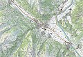
 1116 Feldkirch.jpg 14,000 × 9,600; 102.31 MB
-
 1135 Buchs.jpg 14,000 × 9,600; 112.99 MB
-
 1136 Drei Schwestern.jpg 14,000 × 9,600; 127.47 MB
-
 1155 Sargans.jpg 14,000 × 9,600; 121.66 MB
-
 1156 Schesaplana.jpg 14,000 × 9,600; 130.71 MB
-

-
 Alpenrelief Bregenzerwaldgebirge und Lechquellengebirge.png 948 × 994; 1.96 MB
-
 Reliefkarte Liechtenstein Aussichtstürme.png 828 × 909; 570 KB
-
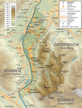
 Grenzverlauf A-FL.png 800 × 976; 878 KB
-
 Liechtenstein topographic map-de Version Tschubby.png 2,189 × 2,862; 2.2 MB
-
 Liechtenstein topographic map-de.png 1,301 × 1,697; 1.23 MB
-
 Liechtenstein topographic map-fr.png 1,301 × 1,697; 1.57 MB
-
 Switzerland topo 25 sheets orig.svg 1,342 × 853; 384 KB


