
Category:Map Lab-fr

- English: Maps which are improved by the french graphic Atelier.
- Deutsch: Karten, die von der Französischen Bildwerkstatt verbessert wurden.
- Français : Ces cartes ont été améliorées par les Wikigraphistes francophones de l'Atelier graphique.
Template used to mark the improved images : {{Atelier graphique carte}}
As of 2025/12/08, there are 4,393 files in Category:Map Lab-fr.
For the common images improved by the Atelier graphique, see : Category:Graphic Lab-fr
![]()
![]()
This map was made or improved by the Wikigraphists of the Atelier graphique. You can propose maps or images to clean up and improve as well.
Cette carte a été créée ou améliorée par les Wikigraphistes de l'Atelier graphique. Vous pouvez également y proposer des cartes ou des images à améliorer.
Media in category "Map Lab-fr"
The following 200 files are in this category, out of 4,393 total.
(previous page) (next page)-
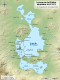
 Alpes-de-Haute-Provence department relief location map.jpg 978 × 955; 591 KB
-
 Alpes-de-Haute-Provence-Position.svg 507 × 553; 145 KB
-
 Alpes-Maritimes department location map.svg 702 × 805; 1.44 MB
-
 Alpes-Maritimes department relief location map.jpg 822 × 942; 414 KB
-
 Alpes-Maritimes-Position.svg 507 × 553; 145 KB
-
 Alpilles topographic map-fr.svg 830 × 511; 1.31 MB
-
 Alps-Mediterranean Euroregion 2007-2015 map-fr.svg 1,465 × 1,126; 341 KB
-
 Alps-Mediterranean Euroregion map-de.svg 1,465 × 1,126; 228 KB
-
 Alps-Mediterranean Euroregion map-en.svg 1,465 × 1,126; 344 KB
-
 Alps-Mediterranean Euroregion map-fr.svg 1,716 × 1,201; 282 KB
-
 Alps-Mediterranean Euroregion map-it.svg 1,465 × 1,126; 344 KB
-
 Alsace Lorraine departments evolution map-fr.svg 600 × 450; 98 KB
-
 Alsace-Champagne-Ardenne-Lorraine region relief location map.jpg 1,916 × 1,613; 1.54 MB
-
 Altimetria Italia-fr.svg 700 × 700; 34 KB
-
 Alto Magdalena Pipeline administrative map-fr.svg 1,301 × 1,708; 1.13 MB
-
 Alto Magdalena Pipeline physical map-fr.svg 1,301 × 1,708; 1.13 MB
-
 Amanipodagrion gilliesi distribution map.svg 1,549 × 1,475; 1.59 MB
-
 Amazon river basin-fr.png 434 × 366; 44 KB
-
 Amazonas drainage basin map-fr.svg 1,101 × 1,442; 1.46 MB
-
 America drainage basin map.svg 337 × 367; 482 KB
-
 American attack on Quebec-fr.svg 883 × 1,077; 109 KB
-
 American Coot-map-localisation-fr.svg 470 × 503; 260 KB
-
 Amphiprioninae distribution map-blank.svg 1,000 × 500; 2.85 MB
-
 Anahim Volcanic Belt-en.svg 2,334 × 832; 723 KB
-
-fr.svg/120px-Ancient_greek_dialects_(-400)-fr.svg.png) Ancient greek dialects (-400)-fr.svg 660 × 555; 574 KB
Ancient greek dialects (-400)-fr.svg 660 × 555; 574 KB
-
 Andorra topographic map-de.svg 1,625 × 1,300; 1.58 MB
-
 Andorra topographic map-en.svg 1,625 × 1,300; 1.56 MB
-
 Andorra topographic map-fr.svg 1,625 × 1,300; 1.58 MB
-
 Andorra topographic map-pl.svg 1,625 × 1,300; 1.56 MB
-
 Andorra topographic map-ptbr.svg 1,625 × 1,300; 1.54 MB
-
 Andorra topographic map-sr.svg 1,625 × 1,300; 1.56 MB
-
 Andree expedition-fr.png 2,222 × 1,833; 813 KB
-
 Anglo American War 1812 Locations map-fr.svg 1,494 × 830; 206 KB
-
 Angola carte.png 330 × 355; 29 KB
-
 Angouleme location map.svg 886 × 744; 5.66 MB
-
 Anisolabis seychellensis distribution map.svg 1,045 × 1,254; 1,020 KB
-
 Anjouan topographic map-fr.svg 841 × 687; 764 KB
-
 Anodonthyla boulengerii map-fr.svg 545 × 533; 458 KB
-
 Anser anser migration map-fr.svg 843 × 805; 734 KB
-
_2-fr.svg/120px-Antarctic_expedition_map_(Nimrod)_2-fr.svg.png) Antarctic expedition map (Nimrod) 2-fr.svg 443 × 455; 147 KB
Antarctic expedition map (Nimrod) 2-fr.svg 443 × 455; 147 KB
-
-fr.svg/120px-Antarctic_expedition_map_(Nimrod)-fr.svg.png) Antarctic expedition map (Nimrod)-fr.svg 1,898 × 1,865; 334 KB
Antarctic expedition map (Nimrod)-fr.svg 1,898 × 1,865; 334 KB
-
 Antarctica blank 2.svg 1,139 × 1,262; 43 KB
-
 Antarctica blank.svg 804 × 804; 39 KB
-
 Antarctica Farthest Souths-fr.svg 1,144 × 1,289; 94 KB
-
 Antarctica ice shelves-en.svg 410 × 379; 153 KB
-
 Antarctica ice shelves-fr.svg 384 × 355; 130 KB
-
 Antarctique carte.png 502 × 617; 71 KB
-
 Antigua et Barbuda carte.png 329 × 354; 20 KB
-
 Antilophia bokermanni distribution map.svg 1,780 × 1,665; 1.71 MB
-
 Anvers map-fr.svg 1,171 × 954; 74 KB
-
 Aomori-ken géolocalisation relief.svg 1,720 × 1,753; 1.73 MB
-
 Aomori-ken géolocalisation.svg 1,720 × 1,753; 1.49 MB
-
 Apaporis drainage basin map-fr.svg 1,101 × 1,442; 1.47 MB
-
 Aphanius transgrediens distribution map.svg 1,828 × 1,577; 2.22 MB
-
 Apis andreniformis distribution map.svg 863 × 443; 1.85 MB
-
 Apis cerana distribution map.svg 863 × 443; 1.85 MB
-
 Apis distribution map.svg 863 × 443; 1.85 MB
-
 Apis dorsata distribution map.svg 863 × 443; 1.85 MB
-
 Apis florea distribution map.svg 863 × 443; 1.85 MB
-
 Apis koschevnikovi distribution map.svg 863 × 443; 1.85 MB
-
 Apis mellifera distribution map.svg 863 × 443; 1.85 MB
-
 Apis nigrocincta distribution map.svg 863 × 443; 1.85 MB
-
 Appleoutput-fr.png 1,600 × 960; 473 KB
-
 Aquitaine region location map.svg 726 × 928; 3.64 MB
-
 Aquitaine region relief location map.jpg 1,534 × 1,960; 1.5 MB
-
 Aquitaine-Limousin-Poitou-Charentes region location map.svg 722 × 1,017; 6.81 MB
-
 Aquitaine-Limousin-Poitou-Charentes region relief location map.jpg 1,204 × 1,695; 1.19 MB
-
 Aquitani tribes map-fr.svg 878 × 750; 1.27 MB
-
 Archeological sites - wine and oil.svg 2,472 × 1,215; 304 KB
-
 Archipel de Riou topographic map-blank.svg 1,052 × 840; 546 KB
-
 Archipel de Riou topographic map-fr.svg 1,052 × 840; 936 KB
-
 Arctic-fr.svg 505 × 633; 1.59 MB
-
 Ardeche department location map.svg 666 × 992; 2.21 MB
-
 Ardeche department relief location map.jpg 1,036 × 1,544; 911 KB
-
 Ardennes department location map.svg 514 × 514; 1,015 KB
-
 Ardennes department relief location map.jpg 1,256 × 1,257; 1.34 MB
-
 Ardennes-Position.svg 507 × 553; 145 KB
-
 Ardèche-Position.svg 507 × 553; 145 KB
-
 Ariège department location map.svg 431 × 351; 1.04 MB
-
 Ariège department relief location map.jpg 1,054 × 858; 1.03 MB
-
 Ariège-Position.svg 507 × 553; 145 KB
-
 Arles centre-ville map-fr.svg 1,450 × 920; 209 KB
-
 Arles general map-fr.svg 1,150 × 1,300; 36 KB
-
 Armenian Genocide Map-en.svg 2,574 × 1,264; 464 KB
-
 Armenian Genocide Map-fr.svg 2,574 × 1,264; 518 KB
-
 Armenian Genocide Map-mk.svg 2,574 × 1,264; 465 KB
-
 Armenian Genocide Map-sr-ec.svg 2,574 × 1,264; 465 KB
-
 Arnica Montana Culture In Scotland-fr.svg 1,024 × 716; 513 KB
-
 Arquipélago das Berlengas-en.svg 1,643 × 2,743; 209 KB
-
 Arquipélago das Berlengas-fr.svg 1,643 × 2,743; 209 KB
-
 Arquipélago das Berlengas-mk.svg 1,643 × 2,743; 210 KB
-
 Arquipélago das Berlengas-pt.svg 1,643 × 2,743; 209 KB
-
 Arrondissement de Grasse in PACA locator map.svg 2,732 × 2,367; 97 KB
-
 Arrondissements et cantons des Cotes-d'Armor.svg 711 × 544; 126 KB
-
 Arshakuni Armenia 150-ca.svg 2,717 × 1,595; 832 KB
-
 Arshakuni Armenia 150-en.svg 2,717 × 1,595; 877 KB
-
 Arshakuni Armenia 150-fr.svg 2,717 × 1,595; 763 KB
-
 Artaxiad Armenia 80BC-fr.svg 2,960 × 2,140; 11.09 MB
-
 Artsakh administrative blank map.svg 875 × 1,005; 339 KB
-
 Artsakh location map.jpg 1,750 × 2,010; 253 KB
-
.jpg/120px-Artsakh_relief_location_map_(1994-2020).jpg) Artsakh relief location map (1994-2020).jpg 700 × 805; 109 KB
Artsakh relief location map (1994-2020).jpg 700 × 805; 109 KB
-
 Artsakh relief location map.jpg 700 × 805; 377 KB
-
 Ascophyllum nodosum distribution map-fr.svg 1,048 × 931; 1.05 MB
-
 Asia satellite plane shaded.jpg 800 × 464; 84 KB
-
 Asie-fr.svg 1,100 × 837; 968 KB
-
 Asie.svg 1,100 × 837; 567 KB
-
 Asinara map.svg 601 × 650; 1.62 MB
-
 Assam protected areas map-blank.svg 2,393 × 1,956; 417 KB
-
 Asterophrys turpicola map-fr.svg 670 × 400; 395 KB
-
 Atelopus balios distribution map.svg 1,499 × 1,511; 1.63 MB
-
 Atomic bomb 1945 mission map-fr.svg 2,111 × 2,663; 316 KB
-
 Atterrages occidentaux.svg 1,601 × 1,369; 714 KB
-
 Aube department location map.svg 536 × 442; 1.21 MB
-
 Aube department relief location map.jpg 1,310 × 1,081; 1.22 MB
-
 Aube regions map-fr.svg 540 × 394; 78 KB
-
 Aube-Position.svg 507 × 553; 145 KB
-
 Aude department location map.svg 496 × 379; 1.16 MB
-
 Aude department relief location map.jpg 1,214 × 925; 1.14 MB
-
 Aude-Position.svg 507 × 553; 145 KB
-
 Aurignacian culture map-fr.svg 720 × 540; 99 KB
-
 Aurora's drift map-fr.svg 1,560 × 1,264; 415 KB
-
 Australia group map.svg 940 × 477; 1.94 MB
-
.svg/120px-Austrasia_Frisia_and_Saxony_481-814_(svg).svg.png) Austrasia Frisia and Saxony 481-814 (svg).svg 610 × 566; 805 KB
Austrasia Frisia and Saxony 481-814 (svg).svg 610 × 566; 805 KB
-
 Austria-geographic map-blank.svg 2,060 × 1,200; 9.51 MB
-
 Austria-Hungary-fr.svg 1,898 × 1,385; 85 KB
-
 Austria-Hungary-mk.svg 1,898 × 1,385; 84 KB
-
 Austrochaperina derongo map-fr.svg 670 × 400; 386 KB
-
 Austrochaperina guttata map-fr.svg 670 × 400; 386 KB
-
 Austrochaperina macrorhyncha map-fr.svg 670 × 400; 390 KB
-
 Austrochaperina palmipes map-fr.svg 670 × 400; 390 KB
-
 Austrochaperina rivularis map-fr.svg 670 × 400; 385 KB
-
 Autoroute 19.png 706 × 677; 104 KB
-
 Autosnelwegen België.svg 1,014 × 828; 79 KB
-
 Autriche hydro-de.svg 711 × 399; 164 KB
-
 Autriche hydro-fr.svg 711 × 399; 233 KB
-
 Auvergne region relief location map.jpg 548 × 667; 256 KB
-
 Auvergne-Rhône-Alpes region location map.svg 1,052 × 825; 5.6 MB
-
 Auvergne-Rhône-Alpes region relief location map.jpg 1,520 × 1,192; 1.16 MB
-
 Aveyron department location map.svg 536 × 594; 1.69 MB
-
 Aveyron department relief location map.jpg 1,310 × 1,452; 2.05 MB
-
 Aveyron-Position.svg 507 × 553; 145 KB
-
 Avignon tramway map.svg 780 × 579; 69 KB
-
 Az-qa-location-fr.svg 443 × 300; 188 KB
-
 Az-qa-location-tr.svg 443 × 300; 177 KB
-
 Azerbaijan topographic map-fr.svg 757 × 502; 3.07 MB
-
 Azerbaijan topographic map-it.svg 757 × 502; 3.06 MB
-
 Azerbaijan topographic map-lt.svg 757 × 502; 3.15 MB
-
 Azerbaijan topographic map-mk.svg 757 × 502; 3.14 MB
-
.svg/120px-Aztec_Empire_(orthographic_projection).svg.png) Aztec Empire (orthographic projection).svg 550 × 550; 102 KB
Aztec Empire (orthographic projection).svg 550 × 550; 102 KB
-
 Aztec Empire 1519 map-fr.svg 1,898 × 1,462; 326 KB
-
 Aztec Empire 1519 map-mk.svg 1,898 × 1,462; 301 KB
-
 Aztec Empire 1519 map-pt.svg 1,898 × 1,462; 306 KB
-
 Aztec empire 1519-fr.svg 1,225 × 924; 27 KB
-
 Aztec empire 1519-mk.svg 1,225 × 924; 27 KB
-
 Aï Khanoum and Ashoka Empire-fr.svg 1,500 × 1,509; 496 KB
-
 Aïn Sefra territory 1934-1955 map-fr.svg 1,287 × 1,278; 1.84 MB
-
 Bade 1806 1945.png 1,952 × 2,880; 328 KB
-
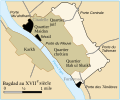 Bagdad XVIIe century-fr.svg 660 × 550; 79 KB
-
 Bagratuni Armenia 1000-en.svg 2,717 × 1,595; 840 KB
-
 Bagratuni Armenia 1000-fr.svg 2,717 × 1,595; 815 KB
-
 Bagratuni Armenia 1000-tr.svg 2,717 × 1,595; 779 KB
-
 Baie des Cochons locator map.svg 851 × 344; 623 KB
-
 Baltic region location map.svg 539 × 599; 4.72 MB
-
 Baltic region topographic map.svg 539 × 599; 5.26 MB
-
 Banks.png 280 × 230; 12 KB
-
 Barcelona Barris map.svg 1,900 × 1,050; 325 KB
-
 Barcelona Districts map.svg 1,102 × 992; 182 KB
-
 Barents 1942.svg 964 × 1,088; 130 KB
-
 Barents sea map blank.png 1,200 × 1,098; 252 KB
-
 Barents sp.png 655 × 599; 170 KB
-
 Bas-Rhin department location map.svg 1,047 × 1,167; 379 KB
-
 Bas-Rhin department relief location map.jpg 1,047 × 1,167; 347 KB
-
 Bas-Rhin-Position.svg 507 × 553; 145 KB
-
 Base map of Persian Gulf-fr.svg 755 × 598; 1.04 MB
-
 Basin of Mexico 1519 map-en.svg 1,412 × 1,883; 551 KB
-
 Basin of Mexico 1519 map-es.svg 1,412 × 1,883; 526 KB
-
 Basin of Mexico 1519 map-fr.svg 1,412 × 1,883; 528 KB
-
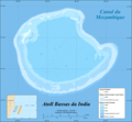 Bassas da India atoll map-fr.png 1,555 × 1,435; 371 KB
-
 Bassas da India atoll map-fr.svg 1,555 × 1,435; 970 KB
-
 Bassin de l'Authie-fr.svg 1,060 × 611; 1.14 MB
-
 Bassin houiller des Vosges et du Jura.svg 389 × 667; 1.7 MB
-
 Bassin houiller Franche-Comté-Alsace-Crop.svg 1,086 × 953; 768 KB
-
 Bassin houiller Franche-Comté-Alsace.svg 2,000 × 1,922; 829 KB
-
 Bassin versant de l'Ogooué-fr.svg 815 × 965; 1.65 MB
-
 Bassins du Cailly et de l'Aubette.svg 638 × 861; 1.42 MB
-
 Bataille de Peta-fr.svg 2,440 × 3,175; 490 KB
-
 Bataille de Sobraon fr.svg 1,150 × 990; 1.2 MB
-
 Bataille Héraclée1.jpg 450 × 384; 106 KB
-
 Bataille Héraclée2.jpg 450 × 384; 99 KB
-
 Battle cannae destruction.-fr.svg 737 × 515; 59 KB
-
 Battle Granicus-fr.svg 1,052 × 744; 76 KB
-
 Battle of Actium-fr.svg 716 × 533; 269 KB
-
 Battle of Bantry Bay,11 May 1689-en.svg 974 × 640; 59 KB
-
 Battle of Bantry Bay,11 May 1689-fr.svg 974 × 640; 48 KB
-
-en.svg/120px-Battle_of_Beachy_Head_(1690)-en.svg.png) Battle of Beachy Head (1690)-en.svg 1,036 × 711; 34 KB
Battle of Beachy Head (1690)-en.svg 1,036 × 711; 34 KB
-
-fr.svg/120px-Battle_of_Beachy_Head_(1690)-fr.svg.png) Battle of Beachy Head (1690)-fr.svg 1,036 × 711; 34 KB
Battle of Beachy Head (1690)-fr.svg 1,036 × 711; 34 KB
-
 Battle of Berezina map-fr.svg 512 × 385; 26 KB
-
 Battle of Greece WWII 1941 map-en.svg 1,848 × 2,500; 1.6 MB
-
 Battle of Greece WWII 1941 map-fr.svg 1,848 × 2,500; 1.68 MB
-
 Battle of Ifoghas-2013-fr.svg 1,842 × 1,582; 3.19 MB


-fr.svg)


_2-fr.svg)
-fr.svg)


.jpg)


.svg)


.svg)


-en.svg)
-fr.svg)


