
Category:Kartenwerkstatt
Deutsch: Diese Kategorie beinhaltet Karten, die in der Kartenwerkstatt erstellt oder verbessert wurden.
- Auch du kannst dort Karten vorschlagen, die zu erstellen, verändern oder übersetzen sind.
English: This category shows maps that have been made or improved in the German Kartenwerkstatt (Map Lab). You can propose maps to improve as well.
As of 2025/12/08, there are 2,350 files in Category:Kartenwerkstatt., and 4,480 files in Category:Kartenwerkstatt (SVG).
Template: {{Kartenwerkstatt}}
Deutsch: Diese Karte wurde in der Kartenwerkstatt erstellt oder verbessert. Auch du kannst dort Karten vorschlagen, die zu erstellen, verändern oder übersetzen sind.
English: This map has been made or improved in the German Kartenwerkstatt (Map Lab). You can propose maps to improve as well.
Vorstellung der Kartenwerkstatt auf der WikiCon 2011 in Nürnberg: ![]()
Pages in category "Kartenwerkstatt"
The following 2 pages are in this category, out of 2 total.
Media in category "Kartenwerkstatt"
The following 200 files are in this category, out of 2,350 total.
(previous page) (next page)-
 Chaetophractus vellerosus distribution map.png 1,147 × 1,589; 2.67 MB
-
 Challenge League 2009-10.png 1,500 × 989; 363 KB
-
 Charles Darwins Weltumseglung mit der HMS Beagle 1831-1836.png 2,314 × 1,223; 841 KB
-
 Charles Darwins Weltumseglung mit der HMS Beagle.png 3,169 × 1,738; 1.64 MB
-
 China topography full res.jpg 6,302 × 3,619; 4.72 MB
-
 China topography.jpg 3,140 × 1,810; 1.44 MB
-
 China Xinjiang relief location map.jpg 2,220 × 1,939; 1.38 MB
-
 Châteaux de la Loire - Karte.jpg 4,057 × 1,545; 5.23 MB
-
 CO-Pipeline.png 931 × 1,065; 1.05 MB
-
 Colombia relief location map.jpg 2,028 × 2,294; 1.1 MB
-
 Comagena Wall 2.png 1,772 × 827; 267 KB
-
 Comagena Wall 3.png 1,772 × 787; 347 KB
-
 Comagena Wall 4.png 1,772 × 827; 296 KB
-
 Comagena Wall.png 1,772 × 829; 321 KB
-
 Comagena.png 1,925 × 1,181; 1.05 MB
-
 Constantinople map German.png 995 × 1,279; 163 KB
-
 Countships of Schaumburg.png 1,713 × 2,362; 314 KB
-
 Crocidura shantungensis distribution map.png 791 × 777; 1.14 MB
-
 Cupiennius getazi distribution map.png 702 × 396; 337 KB
-
 Cupiennius salei distribution map.jpg 604 × 389; 173 KB
-
 Cyanocorax cristatellus distribution map.png 1,217 × 1,496; 2.72 MB
-
 Côtes du Vivarais.png 667 × 908; 594 KB
-
.png/120px-D-Bahnhöfe_Kategorie_1_(bis_2011).png) D-Bahnhöfe Kategorie 1 (bis 2011).png 730 × 867; 1.03 MB
D-Bahnhöfe Kategorie 1 (bis 2011).png 730 × 867; 1.03 MB
-
 D-Bahnhöfe Kategorie 1.png 730 × 867; 1.02 MB
-
 Dahner Felsenland Karte.png 1,200 × 989; 1.42 MB
-
 Danzig 1939.png 695 × 597; 77 KB
-
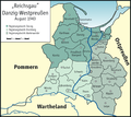 Danzig-Westpreussen.png 1,772 × 1,573; 797 KB
-
 Das Straubinger Erbe.png 1,200 × 723; 329 KB
-
 Dasyprocta azarae distribution map.png 1,217 × 1,496; 2.73 MB
-
 Dasyprocta coibae distribution map.png 1,508 × 845; 1.54 MB
-
 Dasyprocta croconota distribution map.png 1,217 × 1,496; 2.73 MB
-
 Dasyprocta fuliginosa distribution map.png 1,217 × 1,496; 2.72 MB
-
 Dasyprocta guamara distribution map.png 1,217 × 1,496; 2.73 MB
-
 Dasyprocta iacki distribution map.png 1,217 × 1,496; 2.73 MB
-
 Dasyprocta kalinowskii distribution map.png 1,217 × 1,496; 2.73 MB
-
 Dasyprocta leporina distribution map.png 1,217 × 1,496; 2.72 MB
-
 Dasyprocta mexicana distribution map.png 1,508 × 845; 1.54 MB
-
 Dasyprocta prymnolopha distribution map.png 1,217 × 1,496; 2.73 MB
-
 Dasyprocta punctata distribution map.png 1,347 × 1,009; 791 KB
-
 Dasyprocta ruatanica distribution map.png 1,508 × 845; 1.54 MB
-
 Dasyprocta variegata distribution map.png 1,217 × 1,496; 2.73 MB
-
 Dasypus novemcinctus distribution map.png 1,237 × 1,106; 1.3 MB
-
 Dasypus novemcinctus USA distribution map.png 1,367 × 1,064; 1.85 MB
-
 De.wikipedia 2010 - Artikel pro Fläche.png 1,493 × 1,776; 1.97 MB
-
 De.wikipedia 2010 - Artikelwachstum.png 1,493 × 1,776; 1.1 MB
-
 De.wikipedia 2010 - Zeichenanzahl pro Einwohner.png 1,493 × 1,776; 763 KB
-
 De.wikipedia 2017 - Artikelwachstum.png 2,202 × 2,593; 2.31 MB
-
 De.wikipedia 2017 - Durchschnittliche Artikellänge.png 2,202 × 2,592; 1.49 MB
-
 De.wikipedia 2017 - Exzellente, lesenswerte Artikel.png 1,865 × 2,196; 3.61 MB
-
 Dendrohyrax interfluvialis distribution map.png 1,415 × 1,056; 1.11 MB
-
 Deployment He 115.png 1,181 × 1,181; 137 KB
-
 Dersim region in the mid 1930s English.png 1,380 × 679; 1.14 MB
-
 Dersim region in the mid 1930s German.png 1,380 × 679; 1.14 MB
-
 Deserts in Australia en.png 1,500 × 1,479; 2.11 MB
-
 Deserts of Australia de.png 1,500 × 1,479; 2.11 MB
-
 Deutsche Ostsiedlung.png 1,181 × 1,575; 354 KB
-
 Deutscher Orden 1260+Farb.png 1,200 × 1,043; 436 KB
-
 Deutscher Orden 1260.png 1,200 × 1,043; 857 KB
-
 Deutscher Orden 1410+Farb.png 1,200 × 1,043; 370 KB
-
 Deutscher Orden 1410.png 1,200 × 1,043; 632 KB
-
 Deutscher Orden 1466+Farb.png 1,200 × 1,043; 321 KB
-
 Deutscher Orden 1466.png 1,200 × 1,043; 742 KB
-
 Deutschland Bundeswasserstraßen.png 1,825 × 2,317; 5.52 MB
-
 Deutschland Flussgebietseinheiten.png 1,718 × 2,309; 4.96 MB
-
 Deutschland Kassenärztliche Vereinigungen.png 901 × 1,200; 178 KB
-
 Deutschland Lage der 2. Bundesliga Nord.PNG 1,306 × 1,800; 255 KB
-
 Deutschland Lage der 2. Bundesliga Süd.PNG 1,306 × 1,800; 256 KB
-
.png/120px-Deutschland_Lage_der_Oberliga_Hamburg-Schleswig-Holstein_(1994-2004).png) Deutschland Lage der Oberliga Hamburg-Schleswig-Holstein (1994-2004).png 1,500 × 1,836; 348 KB
Deutschland Lage der Oberliga Hamburg-Schleswig-Holstein (1994-2004).png 1,500 × 1,836; 348 KB
-
.png/120px-Deutschland_Lage_der_Oberliga_Niedersachsen-Bremen_(1994-2004).png) Deutschland Lage der Oberliga Niedersachsen-Bremen (1994-2004).png 1,500 × 1,836; 349 KB
Deutschland Lage der Oberliga Niedersachsen-Bremen (1994-2004).png 1,500 × 1,836; 349 KB
-
.png/120px-Deutschland_Lage_der_Oberliga_Nordrhein_(1978-2008).png) Deutschland Lage der Oberliga Nordrhein (1978-2008).png 1,500 × 1,836; 331 KB
Deutschland Lage der Oberliga Nordrhein (1978-2008).png 1,500 × 1,836; 331 KB
-
.png/120px-Deutschland_Lage_der_Regionalliga_Nord_(2000-2008).png) Deutschland Lage der Regionalliga Nord (2000-2008).png 1,500 × 1,836; 391 KB
Deutschland Lage der Regionalliga Nord (2000-2008).png 1,500 × 1,836; 391 KB
-
.png/120px-Deutschland_Lage_der_Regionalliga_Nord_(from_2008).png) Deutschland Lage der Regionalliga Nord (from 2008).png 1,500 × 1,836; 354 KB
Deutschland Lage der Regionalliga Nord (from 2008).png 1,500 × 1,836; 354 KB
-
.png/120px-Deutschland_Lage_der_Regionalliga_Süd_(2000-2008).png) Deutschland Lage der Regionalliga Süd (2000-2008).png 1,500 × 1,836; 389 KB
Deutschland Lage der Regionalliga Süd (2000-2008).png 1,500 × 1,836; 389 KB
-
.png/120px-Deutschland_Lage_der_Regionalliga_Süd_(2008-2012).png) Deutschland Lage der Regionalliga Süd (2008-2012).png 1,500 × 1,836; 336 KB
Deutschland Lage der Regionalliga Süd (2008-2012).png 1,500 × 1,836; 336 KB
-
 Deutschland Lage der Regionalliga Südwest.png 1,500 × 1,836; 351 KB
-
 Deutschland Lage der Regionalliga West-Südwest.png 1,500 × 1,836; 333 KB
-
 Deutschland Lage von Norddeutschland.png 1,500 × 1,836; 350 KB
-
 Deutschland Lage von Ostdeutschland.PNG 1,500 × 1,836; 353 KB
-
 Deutschland Lage von Süddeutschland.png 1,500 × 1,836; 351 KB
-
 Deutschland Lage von Südwestdeutschland.png 1,500 × 1,836; 349 KB
-
 Deutschland Lage von Westdeutschland.png 1,500 × 1,836; 332 KB
-
 Deutschland Landschaften.png 2,267 × 2,896; 10.64 MB
-
 Deutschland Naturraeumliche Grossregionen.png 1,826 × 2,318; 5.4 MB
-
 Deutschland Naturräumliche Haupteinheiten alt.png 1,980 × 2,322; 5.64 MB
-
 Deutschland UNESCO Welterbestätten.png 2,000 × 1,925; 1.44 MB
-
 Deutschland Übersichtskarte.png 1,979 × 2,518; 7.01 MB
-
 Deutschsprachige Wikipedia Stammtische 2008-2009.png 1,282 × 1,500; 520 KB
-
 Deutschsprachige Wikipedia Stammtische 2009-2010.png 1,282 × 1,500; 510 KB
-
 Deutschsprachige Wikipedia Stammtische 2010-2012.png 1,282 × 1,500; 544 KB
-
 Deutschsprachige Wikipedia Stammtische 2012-2014.png 1,282 × 1,500; 557 KB
-
 Deutschsprachige Wikipedia Stammtische 2015-2017.png 1,282 × 1,500; 524 KB
-
 Deutschsprachige Wikipedia Stammtische 2017-2019.png 1,282 × 1,500; 528 KB
-
 Deutschsprachige Wikipedia Stammtische.png 1,223 × 1,500; 655 KB
-
 Dialekte in der DDR.png 1,161 × 1,500; 450 KB
-
 Die Chinesische Mauer - blank-01.jpg 2,652 × 2,133; 1.52 MB
-
 Die Chinesische Mauer - Karte.jpg 2,652 × 2,133; 1.66 MB
-
 Die ersten europäischen Siedlungen in Amerika.png 1,500 × 677; 1.21 MB
-
 Die Ostural-Spur infolge des Kyschtym-Unfalls.jpg 1,901 × 1,291; 844 KB
-
 Diemersteiner Wald Karte.png 1,200 × 989; 1.42 MB
-
.png/120px-Distribution_of_the_Platypus_(Ornithorhynchus_anatinus).png) Distribution of the Platypus (Ornithorhynchus anatinus).png 1,691 × 1,575; 1.06 MB
Distribution of the Platypus (Ornithorhynchus anatinus).png 1,691 × 1,575; 1.06 MB
-
 Distributions of Berber people-map.png 1,885 × 1,326; 1.27 MB
-
 Diözesankarte vor 1517.png 1,483 × 1,820; 369 KB
-
 Dobl-Zwaring im Bezirk GU.png 645 × 645; 13 KB
-
 Dolichotinae distribution map.jpg 800 × 1,147; 578 KB
-
 Dolichotis distribution map.png 1,217 × 1,496; 2.72 MB
-
 Dolichotis patagonum distribution map.png 1,217 × 1,496; 2.73 MB
-
 Dolichotis salinicola distribution map.png 1,217 × 1,496; 2.73 MB
-
 Dolomedes triton distribution map.jpg 966 × 1,005; 710 KB
-
 Dominican Republic relief location map.jpg 1,338 × 1,088; 403 KB
-
 Donau Einzugsgebiet.png 2,130 × 1,137; 4.04 MB
-
 Donautalbahn in Baden und Hohenzollernsche Lande und Württemberg.png 1,000 × 952; 237 KB
-
 Donautalbahn Karte.jpg 1,500 × 841; 801 KB
-
 Dortmund Bezirke und Nachbargemeinden.png 1,200 × 1,021; 326 KB
-
 Dortmund in Nordrhein-Westfalen.png 720 × 675; 455 KB
-
 Dortmund Wahlkreise.gif 1,000 × 893; 76 KB
-
 Dortmund Wahlkreise.png 1,000 × 893; 173 KB
-
 Dorzecze Odry mapa.png 1,060 × 1,090; 1.16 MB
-
 DR Fields of Law.png 3,236 × 2,986; 2.56 MB
-
 Drehstromuebertragung Lauffen-Frankfurt.png 615 × 1,332; 1.31 MB
-
 Dubai Bauprojekte.png 2,000 × 1,941; 828 KB
-
 Dubai Sectors.png 1,050 × 927; 392 KB
-
 Duchy of Nassau.png 1,004 × 1,318; 302 KB
-
 East Brother Light Station map de.png 1,000 × 969; 267 KB
-
 East Brother Light Station map en.png 1,000 × 969; 240 KB
-
 Economic region of Herzegovina.png 1,600 × 1,520; 129 KB
-
 Egypt relief location map 2008 to 2011.jpg 1,055 × 973; 451 KB
-
 Egypt relief location map north.jpg 360 × 393; 105 KB
-
 Egypt relief location map south.jpg 411 × 435; 120 KB
-
 Egypt relief location map.jpg 1,055 × 973; 459 KB
-
 Ehrenhausen an der Weinstraße im Bezirk LB.png 645 × 645; 13 KB
-
_-_Deutsche_Mittelgebirge%2C_Serie_A-de.png/120px-Eifel_(Relief_und_Gewässer)_-_Deutsche_Mittelgebirge%2C_Serie_A-de.png) Eifel (Relief und Gewässer) - Deutsche Mittelgebirge, Serie A-de.png 2,500 × 2,600; 9.95 MB
Eifel (Relief und Gewässer) - Deutsche Mittelgebirge, Serie A-de.png 2,500 × 2,600; 9.95 MB
-
_-_Deutsche_Mittelgebirge%2C_Serie_A-de.png/120px-Eifel_(Relief)_-_Deutsche_Mittelgebirge%2C_Serie_A-de.png) Eifel (Relief) - Deutsche Mittelgebirge, Serie A-de.png 2,500 × 2,600; 9.15 MB
Eifel (Relief) - Deutsche Mittelgebirge, Serie A-de.png 2,500 × 2,600; 9.15 MB
-
 Eifel - Deutsche Mittelgebirge, Serie A-de.png 2,500 × 2,600; 9.83 MB
-
 Einhorn-Tunnel Karte.png 1,424 × 678; 560 KB
-
 Einsatzkommando Cobra.png 1,500 × 780; 306 KB
-
 Eisenbahnkarte Württemberg 1867 Tuttlingen-2.jpg 995 × 1,066; 341 KB
-
 Eisenbahnkarte Württemberg 1867 Tuttlingen.jpg 995 × 1,066; 634 KB
-
 Elbe basin.png 1,309 × 1,381; 1.8 MB
-
 Elbe Einzugsgebiet.png 1,309 × 1,381; 1.96 MB
-
 Electorate of Hesse.png 718 × 1,226; 264 KB
-
 Elektrifizierte Bahnlinien in Schlesien bis 1939.png 1,500 × 1,327; 557 KB
-
 Entstehung Jadebusen Animation.gif 524 × 600; 197 KB
-
 Eoglaucomys fimbriatus distribution map.png 1,426 × 1,173; 1.83 MB
-
 Epixerus ebii distribution map.png 1,492 × 976; 695 KB
-
 Eresus sandaliatus distribution map.jpg 818 × 714; 435 KB
-
 Erster und Zweiter Gotenkrieg-SW.png 2,264 × 2,478; 441 KB
-
 Erster und Zweiter Gotenkrieg.png 1,133 × 1,240; 1.33 MB
-
 Erzgebirge Naturraum map de.png 1,079 × 661; 1.22 MB
-
 Erzgebirge phys map de.png 1,797 × 1,134; 2.33 MB
-
 Erzgebirgspaesse map de.png 1,140 × 719; 1.4 MB
-
 ESC 2010 Points for GER.png 1,000 × 806; 195 KB
-
 ESC 2011 Points for AZ.png 2,833 × 2,250; 752 KB
-
 España y Portugal.png 1,500 × 770; 254 KB
-
 Ethiopian regions map with flags.png 3,838 × 3,112; 867 KB
-
 EU member countries joining order.png 1,475 × 1,200; 981 KB
-
 EU OCT and OMR map de.png 2,206 × 1,358; 1,021 KB
-
 EU OCT and OMR map en.png 2,206 × 1,358; 1,003 KB
-
 Eupetaurus cinereus distribution map.png 919 × 766; 822 KB
-
 Euplectes hordeaceus distribution map.png 1,540 × 1,616; 1.86 MB
-
 Europe bluemarble laea location map.jpg 1,400 × 1,197; 926 KB
-
 Europe natural laea location map.jpg 1,580 × 1,351; 1.15 MB
-
 Europe relief laea location map BG.png 1,580 × 1,351; 3.07 MB
-
 Europe relief laea location map.jpg 1,580 × 1,351; 1.1 MB
-
 Europe satellite image location map.jpg 5,668 × 3,800; 1.83 MB
-
 European trip of Club Atlético Peñarol 1927 DE.png 1,250 × 1,250; 501 KB
-
 Exklaven von Usbekistan, Tadschikistan und Kirgisistan.png 1,494 × 840; 252 KB
-
.png/120px-Expedition_Cabeza_de_Vaca_Karte_(cropped).png) Expedition Cabeza de Vaca Karte (cropped).png 1,990 × 897; 1.89 MB
Expedition Cabeza de Vaca Karte (cropped).png 1,990 × 897; 1.89 MB
-
 Expedition Cabeza de Vaca Karte.png 2,000 × 905; 1.87 MB
-
 Fahrradroute Alter Postweg DE.png 546 × 1,240; 842 KB
-
 Feistritztal im Bezirk HF.png 732 × 889; 17 KB
-
 Feldzug gegen die Nez Perce 1877.png 2,000 × 1,394; 3.7 MB
-
 Fernitz-Mellach im Bezirk GU.png 645 × 645; 13 KB
-
 FFM.png 1,228 × 1,299; 192 KB
-
 Finland 59,5–64N 18,83–30E.png 849 × 692; 592 KB
-
 Finland rel location map.png 1,020 × 1,643; 2.01 MB
-
 Finland ≤ 62°N 30°E.png 847 × 384; 339 KB
-
.png/120px-Fluchtweg_König_Friedrich_Augusts_III._von_Sachsen_(1918).png) Fluchtweg König Friedrich Augusts III. von Sachsen (1918).png 1,350 × 600; 1.63 MB
Fluchtweg König Friedrich Augusts III. von Sachsen (1918).png 1,350 × 600; 1.63 MB
-
 Flughafen und Messe Stuttgart.png 1,225 × 680; 451 KB
-
 Flughäfen in Deutschland.png 1,473 × 1,582; 490 KB
-
 Flughäfen in NRW.png 574 × 535; 75 KB
-
 Football en France 2010-2011.png 2,900 × 2,777; 482 KB
-
 Football en France 2011-2012.png 2,900 × 2,777; 479 KB
-
 Football en France 2012-2013.png 2,900 × 2,777; 480 KB
-
 Football en France 2013-2014.png 2,900 × 2,777; 476 KB
-
 Football en France 2014-2015.png 2,900 × 2,777; 573 KB
-
 Football en France 2015-2016.png 2,900 × 2,777; 502 KB
-
 Forschungsreaktoren in Deutschland.png 1,404 × 1,500; 562 KB
-
 Fowlea piscator distribution map.png 1,668 × 1,151; 1.79 MB
-
 France 40-44.png 3,176 × 2,869; 461 KB
-
 France Midi 45° Latitude.jpg 2,003 × 1,924; 2.25 MB
-
 France South West relief location map.jpg 860 × 839; 294 KB
-
 Frankenweide Karte.png 1,200 × 989; 1.42 MB
-
 Frankfurt-Main Airport Map DE.png 2,253 × 1,890; 1.53 MB
-
 Frankfurt-Main Airport Map EN.png 2,253 × 1,890; 1.52 MB
-
 Frankfurter Kreuz.png 1,445 × 1,838; 1.16 MB
-
 Frederiksborg Amt 1793-1970.png 400 × 479; 9 KB
-
 French departments in the Netherlands and Belgium in 1812.png 2,213 × 2,599; 2.22 MB
-
 Friendly Floatees.png 850 × 523; 56 KB
-
 Fränkische Alb DE.png 1,015 × 1,228; 1.94 MB
-
 FSO Nabarima location.png 995 × 692; 978 KB


.png)


.png)
.png)
.png)
.png)
.png)
.png)
.png)


.png)


_-_Deutsche_Mittelgebirge,_Serie_A-de.png)
_-_Deutsche_Mittelgebirge,_Serie_A-de.png)


.png)


.png)


